The UTBT is located in residential northwest Hillsborough County. Currently, the trail runs along the west shore of Channel A from a trailhead off Memorial Highway/Montaque St, past Waters Avenue, Linebaugh, and then due north to Gunn Highway, Ehrlich Road and ending at Peterson Road Park. The current 7.25 miles make up the first three phases of a four-phase project. Eventually, the Upper Tampa Bay Trail will extend seven to eight more miles, connecting to the 41-mile Suncoast Trail.

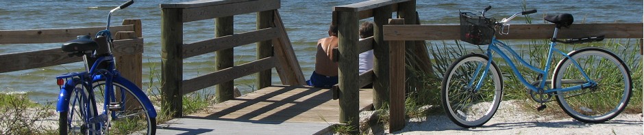
Activities: Biking, skating, walking, jogging, equestrian, fishing
Length: 7.25 miles paved
Extra’s: Water boxes along the trail, overpasses, underpasses, bridges, diverse layout.
Lots to see and do!
County: Hillsborough
Nearby Towns: Tampa
Fee: None
Trailheads & Access south to north:
Memorial Trailhead 7499 Montaque St.
– Cold water and parking.
Directions: Take Hillsborough Ave. west passed the airport, Memorial Highway and Sheldon. Turn right onto Pistol Range Road. Follow Pistol Range Road until it ends at Memorial Highway/Montague St. Take a right onto Memorial Highway/Montague St. The trailhead is a short distance on the right.
Channel Park Trailhead 9201 W Waters Ave
– Full Service with restrooms, parking, water and cola machines.
Directions: Hillsborough Ave. West to Sheldon Road. Turn Right (north) onto Sheldon Road to Waters Ave. Turn left (west) onto Waters Ave. The trailhead is a very short distance on the right.
Wilsky Boulevard Trailhead 10314 Wilsky Blvd.
– Parking, Cold water and restrooms
Directions: From Tampa, take Waters Ave west to Hanley Ave. Head north on Hanley Ave, Hanley becomes Wilsky Blvd at Linebaugh. Cross Linebaugh, the trailhead is on the left/west side of Wilsky Blvd., before the on ramp to the Veterans Expressway.
Ehrlich Conservation Office 7508 Ehrlich Rd
-Parking, Cold water near this trail access.
Directions: From Tampa, take Ehrlich Road west to Gunn Highway. The trail parking area is just east of Gunn Highway, on the south side of Ehrlich. This parking area is next to a old house and is not directly on the trail, and is easily missed. The trail is 2 houses to the west, just before the intersection. Bally Hoo restaurant is adjacent to the trail. There is a water box just south of this location with a map.
Peterson Park 8203 Peterson Rd and Rails Rd.
-Parking, restrooms
Directions: From Tampa take Gunn Highway north.
Peterson Road is a mile north of the Gunn Highway/Sheldon Rd intersection at Sickles High School.
Turn Right onto Peterson Road. The park and the northern terminus of the trail are located ½ mile onthe left.
FLORIDA DEPARTMENT OF
ENVIRONMENTAL PROTECTION
FloridaGreenwaysAndTrails.com
Contact info: Hillsborough County Parks, Recreation and Conservation Dept.
9201 W Waters Ave
Tampa, FL 33635
Info line: (813)801-6729
Fax: (813)801-6730
Manager: Tina A Russo, (813)801-6732 or
Russot@hillsboroughcounty.org


