Seven Hills
 |
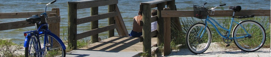
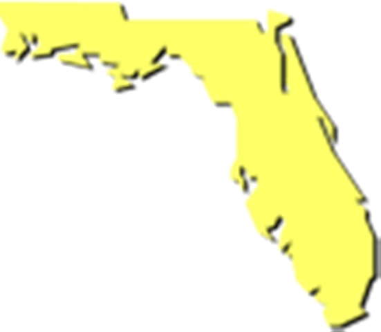
The Seven Hills to the Sea Bicycle Tour is a 283 mile loop around the “panhandle” of Florida. Each day’s destination is a beautiful Florida state park with campgrounds featuring all the amenities (including showers!)
The area this tour encompasses lies just west of Florida’s”big bend”, where the panhandle joins the peninsula. The route follows the coastline along a special regional prominence of land, jutting into Gulf waters and festooned with barrier islands.
Landward, the seascape melts into remnants of the great pine forests that once carpeted north Florida. Farther north the route leaves the flat, sandy coastal plain for a day in the red clay hills of the piedmont. Blue water springs, impassable swamps, rare Torreya trees and the impressive waterway of the great Apalachicola River, all give this bike tour a distinct setting.
Though the loop takes part of its name from the 7 hills of Tallahassee, it actually starts just south of the capital city at Wakulla Springs State Park. The only hills encountered are on two high bridge spans along the coast and inland on the route to Torreya State Park from the Apalachicola River.
The Seven Hills to the Sea Bicycle Tour visits a region rich in beauty, diversity and local tradition. From the springs and woodlands to the white sand beaches of the Gulf and from the haute cuisine of Wakulla Springs Lodge to the spicy smoked mullet, fresh oysters and cheese grits of numerous seafood restaurants enroute, you’ll find a special tapestry of life awaiting your discovery on this bicycle tour.
Day 1. . .Wakulla Springs State Park to Ochlockonee River State Park, 28 miles
Day 2. . .Ochlockonee River State Park to St. George Island State Park, 47 miles
Day 3. . .St. George Island State Park to St. Joseph Peninsula State Park, 45 miles
Day 4. . .St. Joseph Peninsula State Park to Dead Lakes State Recreation Area, 53 miles
Day 5. . .Dead Lakes State Recreation Area to Torreya State Park, 47 miles
Day 6. . .Torreya State Park to Wakulla Springs State Park, 64 miles
Directions to Ride Start
Wakulla Springs State Park is located 15 miles south of downtown Tallahassee. From Tallahassee take US 319 south. 2 miles past Capital Circle (the”Truck Route”), turn left on SR 61, Wakulla Springs Road. In 7.5 miles turn left at the blinking light at the intersection of SR 267 and SR 61. The state park entrance is a few hundred yards from the intersection on the right. Check with rangers at the entrance station for parking instructions.
Services
This loop has convenience stores or small, country grocery stores along the route each day. The towns of Carrabelle, Apalachicola, Port St. Joe and Blountstown have a variety of stores and shops available. The only bicycle shops in the entire area are located in Tallahassee, so be sure to pack spare parts and bicycle supplies before you leave.
Be Aware . . .
As well as these directions, you should bring along your own map, in case you miss a turn, get lost, a road changes, or for any of the other thousands of reasons that you may need to vary your route.
Along many miles of this route there was not much choice of road available. Only one road follows the coast; and although it is very scenic, it carries a moderate (and occasionally heavy) amount of traffic including trucks. The traffic, especially along the coast, intensifies on weekends, holidays and during the summer. St. George Island State Park has such narrow roads and overcrowded conditions through the summer months (May – September) and on holidays like Memorial Day, 4th of July and Labor Day, that it would be wise to plan your trip to avoid St. George at these times.
During the “off season”, October to March, you’ll find the highways and parks quieter. Careful planning with regard to day of departure and time of year can greatly enhance the quality of bicycle riding experience you’ll encounter. (Departures on Mondays or Tuesdays will allow a travel schedule along the coastal section mid-week, when traffic is lighter.)
Another serious impediment along the route is the more northerly bridge across the Apalachicola River on SR 20 between Blountstown and Bristol. The bridge is very narrow with two lanes, high curbs, no walkways, and an abrasive cement railing. The bridge carries heavy truck and car traffic much of the time and gradually curves, limiting forward sight distance. It is 2 miles long. There is no room on this bridge to accommodate bicycles. You should plan on getting a lift over this bridge. The Liberty County Sheriff’s Office in Bristol (904-6432235) is willing to help cyclists find assistance in crossing the bridge. Also Pitts Wrecking Service (904-643-5325) has agreed to ferry cyclists across the bridge for a small fee.
The route follows federal, state, county and local roads. Few of these roads have special provisions for cyclists. Bike paths are mentioned where available, but are often shared with pedestrians and can cross roadways unexpectedly.
Emergency Phone Numbers:The emergency number, 911, is active in all counties along the route except two. In Calhoun County call 904-674-5049. In Liberty County call 904-643-5615.
Low Traffic Alternate Route
If you are planning a trip over this loop during a peak traffic time (May to September), a very good alternate route on the east side of the Apalachicola River avoids much of the coastal traffic and the narrow Apalachicola River bridge on Highway 20. 9.8 miles past Carrabelle Beach, turn right on SR 65 North. Follow SR 65 for 25 miles north to Sumatra.
Enroute to Sumatra, you’ll pass Ft. Gadsden State Historic Site, 2.5 miles west of the highway, where earthworks of the historic fort (built by Andrew Jackson), interpretative kiosk and picnic ground await you. 2 miles before Sumatra, camping is available in the Apalachicola National Forest at Wright Lake (54.3 miles from Ochlockonee River State Park). To find Wright Lake Campground, turn left 4 miles north of the side road to Ft. Gadsden on Forest Road (FR) 101 (unpaved) to the west for about one mile, then veer right onto FR 101-C. Campsites are shaded by tall pines and have flush toilets and showers in the restrooms. Swimming is available in an unsupervised but marked portion on the lake.
From Sumatra, continue on SR 65 for 11 miles to CR 12. Turn left on CR 12 and follow it for 24 miles to Bristol. At Bristol you can return to the cue sheet for Day 5 into Torreya State Park. Distance from Wright Lake to Torreya is approximately 51.5 miles. Total mileage for the alternate route is 60 miles. It will shorten the loop by 2 days and 87 miles.
If you decide to take this alternate route, be sure to stock up on groceries in Carrabelle. You will be traveling along the entire west side of the Apalachicola National Forest, and stores and services are non-existent for 60 miles.
Many thanks to the Florida Department of Environmental Protection for this tour description.


